
キャプティブ 2026.04.22
CA84 2026年4月20日三陸沖M7.5地震
目次
Copyright © Shinichiro Hatani 2026 All rights reserved
For those who prefer to read this column in English, the Japanese text is followed by a British English translation, so please scroll down to the bottom of the Japanese text.
「キャプティブ」は、「地震リスクに対するリスクマネジメント・ツールとして大きな役割を果たす存在」であるが、地震リスクの規模が大きければ大きいほどその効用は高くなる、地震が発生した場合の損害額が大きくなり自前の資産ではその損失を賄えないため、「外部の資産=保険」の力を借りる必要性が高いためである。
更に、地震の規模が大きくなればなるほど、直接的な被害だけではなく、インフラが受ける被害も大きくなり、地震から復興しようとする企業にとっては、その足枷になるリスクが高く、「地震リスクへの十分な備え」が必要となるからである。
こうしたことから、キャプティブは南海トラフ巨大地震等、大規模な「海溝型地震」に備えようとする企業にとっては、必須の企業戦略、リスクマネジメント・ツールと言われている。
この「海溝型地震」は、地球規模の「プレート」の境界で発生する点から、巨大地震になる可能性が高い。
1.2026年4月20日の三陸沖地震
4月20日(月)、下記のような大きな地震が起きた
| 発生時刻 | 2026年4月20日 16時53分頃 |
| 震源地 | 三陸沖(宮古の東100km付近) |
| 最大震度 | 5強 |
| マグニチュード(M) | 7.5 |
| 深さ | 10km |
| 緯度/経度 | 北緯39.8度/東経143.2度 |
| 情報 | 津波警報等(大津波警報・津波警報あるいは津波注意報)、緊急地震速報が発表された。 |
「断層型地震」であった1995年の阪神・淡路大震災は、甚大な被害を被ったがマグニチュード(M)は7.3であった。一方、「海溝型地震」であった2011年の東日本大震災のマグニチュード(M)は9.0。地震の規模・エネルギー量の差は実に300倍以上であった。如何に海溝型地震が巨大地震化するかが解る。
気象庁の公式WEBサイトによると、「千島海溝・日本海溝沿いの巨大地震の想定震源域及び想定震源域に影響を与える外側のエリアでモーメントマグニチュード(Mw)7.0以上の地震が発生した場合」は、「北海道・三陸沖後発地震注意情報」が発表されるとなっているが、「平常時に比べるとMw8クラス以上の地震発生の可能性は相対的に高まっていると考えられる」ため、昨年12月9日に続き、2回目となる「北海道・三陸沖後発地震注意情報」が、7道県、182の市町村を対象にして発表された。
2.日本海溝・千島海溝地震
南海トラフ地震のリスクが、「富士山噴火」とともに、それらへの備えがここ数年叫ばれているが、最も危惧されている海溝型地震は、政府中央防災会議が2021年12月21日その被害想定を発表した「日本海溝・千島海溝沿いの巨大地震 」である。
地震規模の想定は「M8.8以上」であり、同被害想定報告書の中で「地震の発生確率が高く30年以内の地震発生率が26%以上」とされている地震である。先月から今月にかけて地震が発生している北海道西方沖でも、「南海トラフ地震」と同規模の巨大地震が30年以内に26%以上の確率で発生するということである。
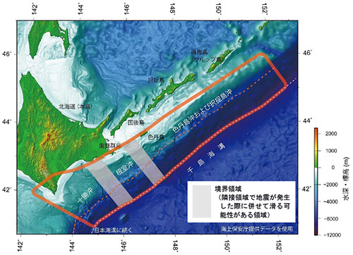
近未来に発生する、この北海道西方沖の地震は「千島海溝の17世紀型」と呼ばれている。この名称は、津波堆積物の調査から、太平洋プレートが北米プレートの下に沈み込んでいる千島海溝で17世紀に起きた巨大地震に由来している。同様に、津波堆積物の調査によって、17世紀以前にも、300~400年の周期で大津波を伴う巨大地震が千島海溝では発生していたことも判明している。
一方、日本海溝で起きた巨大地震の筆頭は、2011年の東日本大震災であるが、政府の発表した「令和3年 12 月 21 日」付け「中央防災会議 防災対策実行会議 日本海溝・千島海溝沿いの巨大地震 対策検討ワーキンググループ」の被害想定資料の冒頭(総括)には被害想定に関する記述がある。
本被害想定は、日本海溝・千島海溝沿いの巨大地震で発生する可能性のある事象を積雪寒冷地特有の事象も含め、東日本大震災の被災状況や復旧推移をもとに、一部、阪神・淡路大震災での状況を踏まえて想定したものである。被害の様相は、地震による強い揺れや津波の発生状況により異なるが、震源の場所によって、「日本海溝モデル」と「千島海溝モデル」の 2つのケースを記している。
「日本海溝モデル」、震源が日本海溝の場合、北海道の沖合から岩手県沖にかけてM9.1の巨大地震が発生、岩手県宮古市では29.7mの大津波が発生すると想定している。地震の発生時期、住民の避難状況から、6つのシナリオを想定しているが、冬の深夜に地震が起きた場合には、住民の早期避難も難しいため、犠牲者は北海道で13万7千人、青森県4万1千人、岩手県1万1千人、宮城県8500人、他県も合わせて合計19万9000人と推定、経済被害は31兆3千億円に及ぶと推計している。
一方、「千島海溝モデル」では北海道襟裳岬の東沖合を震源域と想定している。このモデルでは、日本海溝モデルよりも地震の規模は更に大きく東日本大震災を上回るM9.3の地震が発生すると想定している。この巨大地震によって、最大で27.9mの大津波が押し寄せ、犠牲者は北海道で8万5千人、他県も含めて合計で10万人と推定、経済被害は16兆7千億円に及ぶと推計するものである。
甚大な被害を引き起す「日本・千島海溝巨大地震」が、30年以内に26%以上の確率で地震が発生するという被害予測を国が出しているのである。果たして、その「備え」は十分であろうか。
(出典:政府「地震調査研究推進本部」ホームページ)
3.過去の「津波堆積物」
「国立研究開発法人 産業技術総合研究所」(産総研)は、東日本大震災の前、2010年に「450〜800年間隔で東北地方を津波が襲っていたこと」、そのために「今後も津波を伴う大地震が発生する可能性があること」を予見、その研究結果を国に報告していた。しかし、この研究報告が広く人々の目に触れることになったのは、東日本大震災が起きた後であった。
それ以前、当時の政府の「中央防災会議」に於ける「地震予知」では、数理的な解析を主とする地震学に偏重する傾向が強かったため大きく取り上げられることはなかったからである。この反省から、その後の「中央防災会議」では、「古文書の分析や津波堆積物・海岸・地形調査によって、想定地震や津波被害を設定すること。地震学、地質学、考古学、歴史学などあらゆる見地から地震研究を充実させることを検討すべき」という趣旨の提言がまとめられた。
一般的に、地震の中長期予測については、地震学を基に、古来の文献記録や活断層の調査等を加えてなされてきたが、東日本大震災を「予見」した産総研では、それまであまり注目されてこなかった津波堆積物の調査をおこなうことによって、「その地質構成から過去に発生した地震の規模や津波の大きさ」を見極めた。
「津波堆積物」とは、津波によって海底の砂などが陸上に押し上げられ、陸上の地層に「砂層」として残されたものである。この津波堆積物のボーリング調査をおこない、発生した地震の津波の高さ、浸水域等の被害の状況を「文献に記されていない過去の地震の証拠」として明示するものである。
本コラムでも何度か記したが、「学問の神様、菅原道真」を中心に編纂された「日本三代実録」には、東北地方で869年に発生した「貞観地震」と「貞観津波」について記されていて、古くから、この地震の存在は知られていた。
30年以上前、既に貞観津波による津波堆積物も発見されていたが、「どこが震源なのか」が不明だったため、「地震調査研究推進本部」による海溝型地震の長期評価からは外されていた。
産総研では、仙台平野の地層の堆積物から、1000年以上に渡るこの土地の様子を調べ、貞観地震発生当時の海岸線の位置も考慮して貞観津波によるおおよその浸水域を推測することができた。その結果、その浸水域は、それまでに観測されたどの津波よりも巨大であったことが判明した。
また、「津波堆積物の分布状況」から浸水域を見極めることができ、その結果過去の津波の規模も推定できるようになった。さらに、浸水域、津波堆積物の量等から、津波の規模も推定でき、この津波の大きさによって、「震源を推測、特定できる」ようになったのである。このように、津波堆積物は、「過去の地震の語り部」として、地震の大きさ、震源を現代の人々に語りかけている。
今回のまとめ
マグニチュードが1つ大きくなると地震のエネルギーは約30倍、マグニチュードが2つ違うと地震のエネルギーは約1,000倍(≒30×30倍)、マグニチュードが3つ大きくなると地震のエネルギーは約30,000倍(≒30×30×30倍)になる。
マグニチュード0.1の差はエネルギーでは約1.4倍の差、マグニチュード0.2の差では約2倍(101.5×0.2 = 100.3 ≒ 1.995)。
東日本大震災のマグニチュードは9.0であったが、「日本・千島海溝巨大地震」の規模は、「千島海溝モデル」ではマグニチュード9.3。
つまり「日本・千島海溝巨大地震」(千島海溝モデル)の地震のエネルギー量は、この計算式から未曾有の被害をもたらした「東日本大震災」の約2.8倍のエネルギー量になる。東日本大震災を超える規模の超巨大地震なのである。
したがって、備えとしても、「できるだけ支払限度額を高くした地震保険を準備する必要」がある。
そのためには、「日本では十分な地震保険キャパシティ(引受力)の確保が困難」であるため、キャプティブの設立によって、海外の再保険市場のサポートを確保する必要がある。
キャプティブを設立して海外の再保険会社からできるだけ多くの再保険サポートを得るようにする必要があるからである。
執筆・翻訳者:羽谷 信一郎
English Translation
Captive (CA) 84 – 20 April 2026: M7.5 earthquake off the Sanriku coast
‘Captives’ play a significant role as risk management tools against earthquake risk; however, their utility increases in proportion to the scale of the earthquake risk. This is because, should an earthquake occur, the extent of damage would be so great that a company’s own assets would be insufficient to cover the losses, thereby heightening the need to rely on ‘external assets—i.e. insurance’.
Furthermore, as the scale of an earthquake increases, not only does direct damage grow, but damage to infrastructure also becomes more severe. For companies attempting to recover from an earthquake, this poses a high risk of becoming a major obstacle, making “adequate preparation for earthquake risk” essential.
For these reasons, captives are regarded as an indispensable corporate strategy and risk management tool for companies seeking to prepare for large-scale “trench-type earthquakes”, such as the Nankai Trough mega-earthquake.
As these ‘trench-type earthquakes’ occur at the boundaries of global ‘tectonic plates’, they have a high probability of becoming massive earthquakes.
1. The Sanriku Offshore Earthquake of 20 April 2026
On Monday, 20 April, a major earthquake occurred as follows
Time of occurrence: Around 16:53 on 20 April 2026
Epicentre: Off the Sanriku coast (approximately 100 km east of Miyako)
Maximum seismic intensity: 5+
Magnitude (M): 7.5
Depth: 10 km
Latitude/Longitude: 39.8°N / 143.2°E
Information: Tsunami warnings (including major tsunami warnings, tsunami warnings or tsunami advisories) and earthquake early warnings were issued.
The 1995 Great Hanshin-Awaji Earthquake, which was a ‘fault-type earthquake’, caused extensive damage but had a magnitude (M) of 7.3. In contrast, the 2011 Great East Japan Earthquake, which was a ‘trench-type earthquake’, had a magnitude (M) of 9.0. The difference in the scale and energy of the earthquakes was more than 300-fold. This clearly demonstrates how trench-type earthquakes can become massive earthquakes.
This major earthquake occurred in the epicentre area of the Great East Japan Earthquake.
According to the Japan Meteorological Agency’s official website, a ‘Hokkaido and Off-Sanriku Aftershock Advisory’ is issued ‘in the event of an earthquake with a moment magnitude (Mw) of 7.0 or greater occurring in the assumed epicentre area of a massive earthquake along the Kuril Trench and Japan Trench, or in the outer area affecting that assumed epicentre area’. However, as “the probability of an earthquake of Mw 8 or greater occurring is considered to be relatively higher than under normal conditions”, a second “Hokkaido and Sanriku Offshore Aftershock Advisory” – following the one issued on 9 December last year – was issued, covering seven prefectures and 182 municipalities.
2. Japan Trench and Kuril Trench Earthquakes
Whilst the risk of a Nankai Trough earthquake, alongside a ‘Mount Fuji eruption’, has been highlighted in recent years, with calls for preparedness, the trench-type earthquake of greatest concern is the ‘mega-earthquake along the Japan Trench and Kuril Trench’, for which the Central Disaster Management Council announced its damage projections on 21 December 2021.
The estimated magnitude is ‘M8.8 or greater’, and the damage projection report states that this is an earthquake with a ‘high probability of occurrence, with a 26% or higher probability of occurring within the next 30 years’. This means that even in the waters west of Hokkaido, where earthquakes have been occurring from last month through to this month, there is a 26% or higher probability of a massive earthquake on the same scale as the ‘Nankai Trough Earthquake’ occurring within the next 30 years.
This earthquake, expected to occur off the western coast of Hokkaido in the near future, is referred to as the ‘17th-century type of the Kuril Trench’. This name derives from a massive earthquake that occurred in the 17th century in the Kuril Trench—where the Pacific Plate subducts beneath the North American Plate—as revealed by investigations of tsunami deposits. Similarly, investigations of tsunami deposits have revealed that even prior to the 17th century, massive earthquakes accompanied by large tsunamis occurred in the Kuril Trench at intervals of 300 to 400 years.
Meanwhile, whilst the Great East Japan Earthquake of 2011 is the most prominent example of a massive earthquake occurring in the Japan Trench, the opening section (summary) of the damage estimation document published by the government on 21 December 2021 by the ‘Working Group on Countermeasures for Massive Earthquakes along the Japan Trench and Kuril Trench’ of the Central Disaster Management Council’s Disaster Prevention Measures Implementation Committee contains a description of the damage estimates.
These damage estimates are based on the damage situation and recovery progress following the Great East Japan Earthquake, and in part on the situation during the Great Hanshin-Awaji Earthquake, taking into account events that could occur during a massive earthquake along the Japan Trench and Kuril Trench, including those specific to snowy, cold regions. Although the nature of the damage will vary depending on the intensity of the seismic shaking and the occurrence of tsunamis, two scenarios—the ‘Japan Trench Model’ and the ‘Kuril Trench Model’—are described, depending on the location of the epicentre.
In the ‘Japan Trench Model’, where the epicentre is located in the Japan Trench, a massive earthquake of magnitude 9.1 is assumed to occur off the coast of Hokkaido to the coast of Iwate Prefecture, with a massive tsunami of 29.7 metres expected to strike Miyako City in Iwate Prefecture. Six scenarios are envisaged based on the timing of the earthquake and the evacuation status of residents. However, as early evacuation would be difficult if the earthquake occurred late at night in winter, the estimated death toll is 137,000 in Hokkaido, 41,000 in Aomori Prefecture, 11,000 in Iwate Prefecture, 8,500 in Miyagi Prefecture, and a total of 199,000 including other prefectures; economic damage is estimated to reach 31.3 trillion yen.
On the other hand, the ‘Kuril Trench Model’ assumes the epicentre to be off the eastern coast of Cape Erimo in Hokkaido. In this model, the scale of the earthquake is even greater than in the Japan Trench Model, with the assumption that an earthquake of magnitude 9.3—exceeding that of the Great East Japan Earthquake—will occur. This massive earthquake is predicted to trigger a tsunami with waves reaching a maximum height of 27.9 metres, resulting in an estimated 85,000 fatalities in Hokkaido and a total of 100,000 across all prefectures, with economic damage estimated at 16.7 trillion yen.
The government has issued a disaster forecast stating that there is a probability of over 26% that the ‘Japan-Kuril Trench Mega-Earthquake’, which would cause catastrophic damage, will occur within the next 30 years. Is our ‘preparedness’ truly sufficient?
3. Past ‘Tsunami Deposits’
The National Institute of Advanced Industrial Science and Technology (AIST) had, prior to the Great East Japan Earthquake in 2010, foreseen that ‘tsunamis had struck the Tohoku region at intervals of 450 to 800 years’ and that, consequently, ‘there was a possibility of major earthquakes accompanied by tsunamis occurring in the future’, and had reported these research findings to the government. However, it was only after the Great East Japan Earthquake occurred that this research report came to the attention of the general public.
This was because, prior to that, the ‘Central Disaster Prevention Council’ of the government at the time had a strong tendency to place excessive emphasis on seismology based primarily on mathematical analysis, meaning the findings were not given significant attention. Drawing on this lesson, subsequent meetings of the ‘Central Disaster Prevention Council’ compiled a recommendation to the effect that: ‘Hypothetical earthquakes and tsunami damage should be established through the analysis of historical documents and surveys of tsunami deposits, coastlines and topography. “It was generally the case that medium- to long-term earthquake forecasts were based on seismology, supplemented by ancient literary records and surveys of active faults; however, the AIST, which “foresee’d” the Great East Japan Earthquake, has since been the subject of much attention.
Generally, medium- to long-term earthquake forecasts have been made based on seismology, supplemented by historical records and surveys of active faults; however, the AIST, which ‘foresee’d’ the Great East Japan Earthquake, determined ‘the magnitude of past earthquakes and the size of tsunamis’ based on the geological composition of the area by conducting surveys of tsunami deposits, which had previously received little attention.
‘Tsunami deposits’ refer to sand and other materials from the seabed that were pushed onto land by a tsunami and remain as ‘sand layers’ within terrestrial strata. By conducting borehole surveys of these tsunami deposits, it is possible to clearly demonstrate the height of the tsunami and the extent of damage, such as inundation areas, caused by the earthquake as ‘evidence of past earthquakes not recorded in historical texts’.
As I have noted several times in this column, the *Nihon Sandai Jitsuroku* (Three Generations of Japanese History), compiled with a focus on Sugawara no Michizane, the ‘God of Learning’, contains records of the ‘Jōgan Earthquake’ and ‘Jōgan Tsunami’ that occurred in the Tōhoku region in 869; the existence of this earthquake has been known since ancient times.
Although tsunami deposits from the Jōgan Tsunami had already been discovered more than 30 years ago, the location of the epicentre remained unknown; consequently, it was excluded from the long-term assessment of trench-type earthquakes conducted by the Headquarters for the Promotion of Earthquake Research. The AIST examined the conditions of this land over a period of more than 1,000 years using sedimentary layers from the Sendai Plain and, taking into account the position of the coastline at the time of the Jōgan Earthquake, was able to estimate the approximate inundation area caused by the Jōgan Tsunami. As a result, it was found that the inundation area was larger than that of any tsunami observed up to that point.
Furthermore, by analysing the distribution of tsunami deposits, it has become possible to identify inundation zones and, consequently, to estimate the scale of past tsunamis. Moreover, by examining factors such as the inundation zone and the volume of tsunami deposits, the scale of the tsunami can be estimated; and based on this magnitude, it has become possible to ‘infer and identify the epicentre’. In this way, tsunami deposits act as ‘storytellers of past earthquakes’, conveying the magnitude and epicentre of these events to people today.
Since the Great East Japan Earthquake of 2011, many researchers have been conducting surveys of tsunami deposits. Numerous tsunami deposits have also been discovered relating to the ‘17th-century-type earthquake in the Kuril Islands and the Japan Trench’, which are contributing to research into earthquake prediction.
Summary of this issue
If the magnitude increases by one, the energy of the earthquake is approximately 30 times greater; if the magnitude differs by two, the energy is approximately 1,000 times greater (≈ 30 × 30); and if the magnitude increases by three, the energy is approximately 30,000 times greater (≈ 30 × 30 × 30).
A difference of 0.1 in magnitude corresponds to a difference in energy of approximately 1.4 times, whilst a difference of 0.2 corresponds to approximately 2 times (101.5 × 0.2 = 100.3 ≈ 1.995).
The Great East Japan Earthquake had a magnitude of 9.0. According to the ‘Kuril Trench Model’, the scale of the ‘Japan-Kuril Trench Mega-Earthquake’ is magnitude 9.3; in other words, based on this calculation, the energy released by the ‘Japan-Kuril Trench Mega-Earthquake’ (Kuril Trench Model) would be approximately 2.8 times that of the Great East Japan Earthquake, which caused unprecedented damage. It is a megathrust earthquake of a magnitude exceeding that of the Great East Japan Earthquake.
Therefore, as a precaution, it is necessary to arrange earthquake insurance with the highest possible payment limit.
To achieve this, as it is difficult to secure sufficient earthquake insurance capacity in Japan, it is necessary to establish a captive to secure support from overseas reinsurance markets.
This is because it is necessary to establish a captive to obtain as much reinsurance support as possible from overseas reinsurance companies.
Author/translator: Shinichiro Hatani