
リスク対応策 2020.11.28
RM51 地名に潜むリスクへ備えるキャプティブ 2(地震に強い街)
目次
Copyright © Shinichiro Hatani 2020 All rights reserved
For those who prefer to read this column in English, the Japanese text is followed by a British English translation, so please scroll down to the bottom of the Japanese text.
学生時代、先に上京した高校時代の親友が住むことを決めたアパート、「部屋も空いているし、探すのも面倒だから、ここでいいか」と同じ安アパートを借りることにした地は、東京都板橋区の東武東上線沿線、「板橋区内で最も地価が高いセレブな地」と言われている常盤台(ときわだい)にあった。戦前、開発当時の東武鉄道社長が「理想の住宅地をつくる」と号令、「田園調布」のように、北口駅前の大きなロータリーから放射状に道路が伸びており、「板橋の田園調布」とも宣伝されている地であった。
確かに、常盤台は、高級住宅街として有名ではあったが、それは「常盤台1丁目、2丁目」のこと。アパートが有った「3丁目」まで、常盤台駅から歩いて行くと、その景観の移り変わりは、見事なぐらいであったことをいまだに思い出す。
結婚を機にその地を離れて居住したのも、「勤務先が有った大手町駅まで一本で通勤できる板橋の地」であったが、「子供も出来て、子育てにもどこか広々とした地を」と探し始めたのが、バブルの絶頂期、当時、関東地方、特に東京都では、地震が頻発、「群発地震」という言葉がマスコミで取り沙汰され、「関東大震災が再び」との声が日増しに高まっていた頃であった。
頻発する地震から「地震に強い場所がいい」という思いが強くなり、損害保険会社勤務の強みを活かし、「地震に強い地を」と色々調べて、決めた地が、多摩市であった。
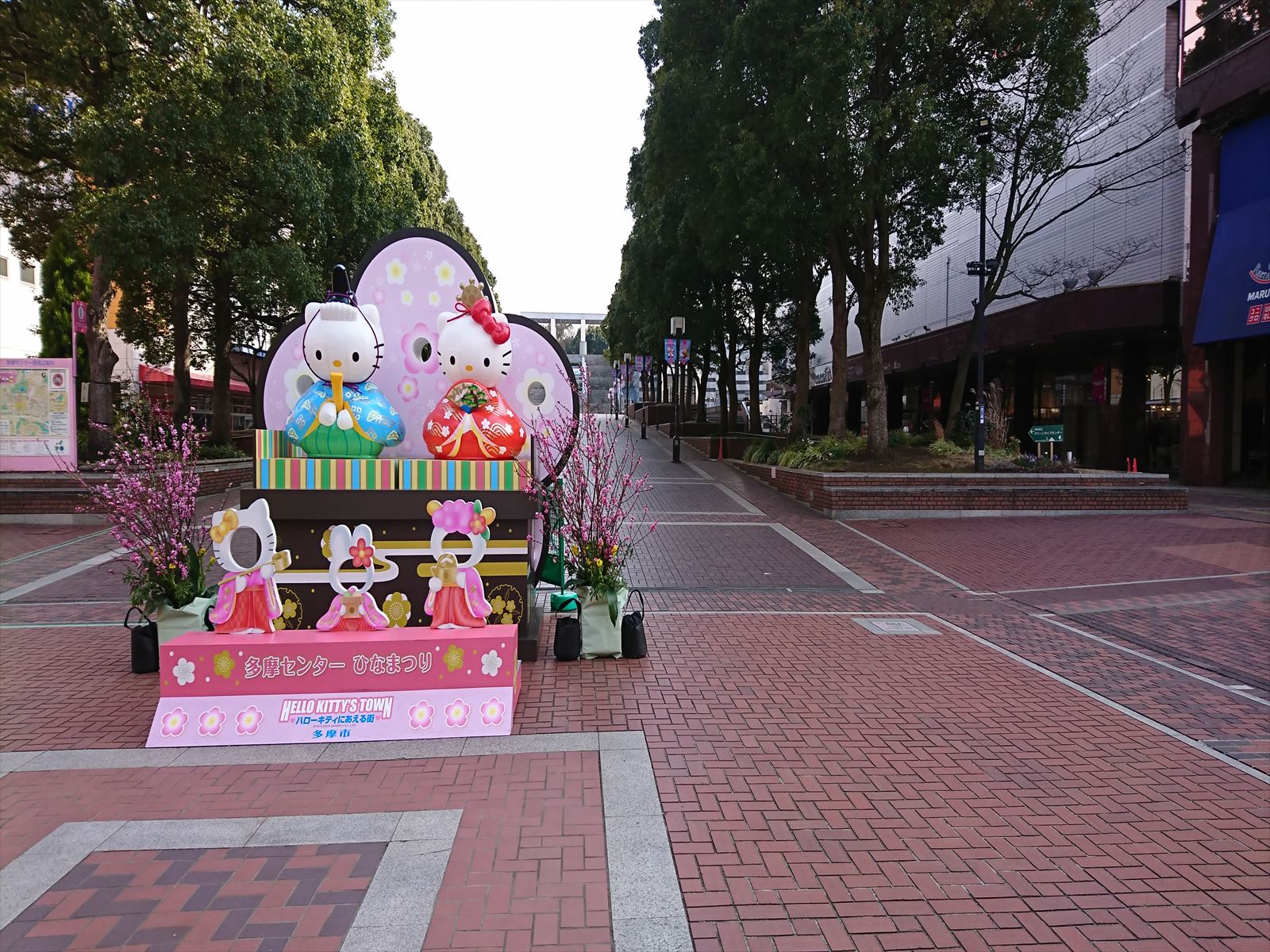
多摩市は、基幹駅の一つ、多摩センター駅近くにサンリオ・ピューロ・ランドがあり、「キティ」に会える街、「Hello Kitty’s Town」として知られている。
Tama City has The ”Sanrio Puroland” near Tama Center Station, one of the main train stations, and is known as “Hello Kitty’s Town”, a town where visitors can meet ” Kitty”.
1.多摩市
多摩市は、東京都心から電車で約30分、京王線、小田急線と二つの鉄道が通っている。この東西を結ぶ鉄道に加え、近いうちに多摩センター駅から南北方向へも「多摩都市モノレール」ができて(2000年に開通)、中央線の立川駅まで結ばれるという交通の利便性が非常に高い点、そして何よりも「地震に強い街」ということが解ったからであった。
多摩市は、多摩丘陵の北端を占める地域、多摩市南部、稲城市、町田市、八王子市にまたがって造成された、「多摩ニュータウン」で有名な街である。「ニュータウン」なので、「団地」ばかりが広がっているかと思って行ってみたら、確かに団地が一面広がっている地域が大半ではあったが、戸建て住宅、ゆったりとマンションが建っている地域もあり様々な様相を見せる街であった。
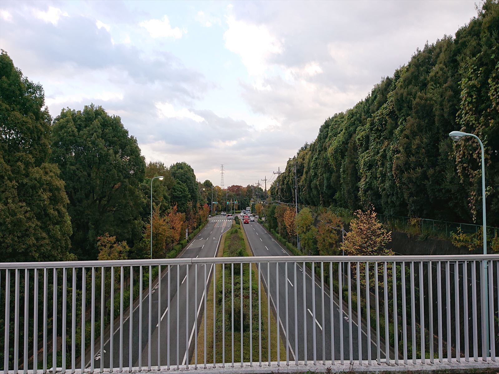
歩いてみると、多摩丘陵の地形をうまく活かしたデザインで街が設計されていることがわかった。自動車の通る「4車線の幹線道路」の上に「歩道」が立体交差して歩車分離が徹底されている。この立体分離された歩行者専用道路が多摩市中に張り巡らされ、数多くの歩行者専用橋が架かり、車道を一切横断することなく、学校や公園、駅前まで歩いて行けるということも解った。
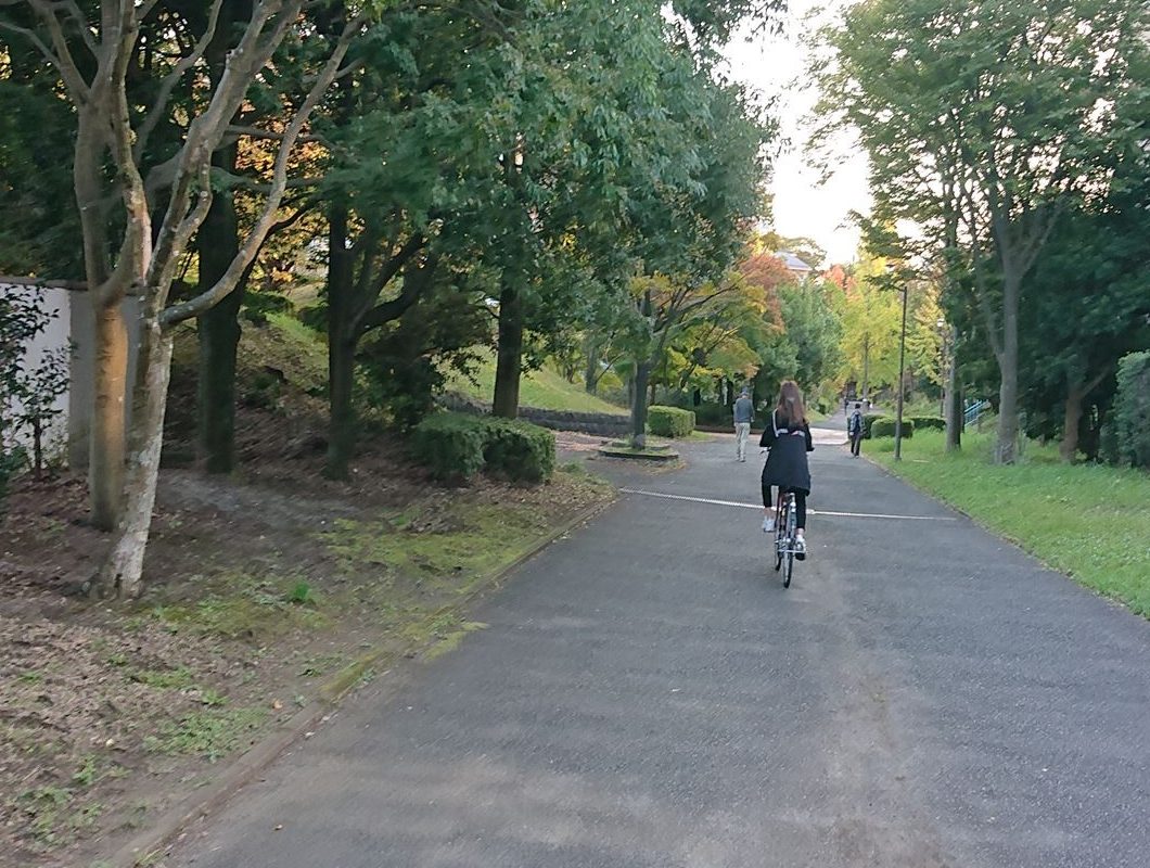
基本設計に「30%以上の緑とオープン・スペースを確保すること」が盛り込まれているため、多摩市の公園面積は11%を超え都内トップとのことであった。当時は「地震リスク対策」がメインであり、「緑が多いから良いな」ぐらいの印象であったが、いまは、コロナ禍で求められている「ソーシャル・ディスタンス」が自然とできている、何事にも広々としている街であると感じている。
「多摩市のホームページ」によると、地盤に関しては、
多摩市域の地形は、いわゆる多摩丘陵の北端部を占める、やや開折された丘陵とこれを刻む小河川沿いに発達する谷底平野等よりなります。北方の聖蹟桜ヶ丘駅周辺には、多摩川の運んできた砂礫泥によって構成されている沖積低地がみられます。
本地域周辺の多摩丘陵の高度をみると、南西方面がもっとも高度が高く、漸次北東方面へ高度を下げていきます。町田市西方の八王子市との境界付近の御殿峠付近で、海抜200メートル前後の高度となりもっとも高くなっています。市域内では天王森公園付近が海抜160メートル前後で最も高く、多摩川沿いの低地では約50メートル前後となり最も低くなっています。この多摩丘陵は、西南西ないし東北東方向の流路をもつ乞田川や大栗川によって分断されています。
本地域の基盤となっているのは、新第三紀鮮新世紀末期から第四紀洪積世前期にかけて浅海に堆積した上総層群です。この上総層群は、より西側にみられる地層ほど古く、多摩市域に見られる地層は下位より平山砂層・連光寺互層・稲城砂層などの各層より構成されています。連光寺互層は、礫・砂・泥の互層です。これらの地層は、いずれも東側に5~6度で、きわめてゆるやかに傾斜しています。平山砂層、連光寺互層中には内湾浅瀬海棲のマガキ・ウネナシトマヤガイ・アズマニシキなどの貝化石を含んでいます。
上総層群をおおって御殿峠礫層が分布しています。この御殿峠礫層は、古相模川によってはこばれた河原の砂礫が堆積してできた地層で、古期のものと新期のものと2段に区別することができます。御殿砂礫層の上位は、いわゆる関東ローム層となっており、下位より多摩ローム層、下末吉ローム層、武蔵野ローム層、立川ローム層に区分されています。この関東ローム層は赤土とも呼ばれ、箱根火山や富士火山などの噴出物が偏西風によって運ばれて推積したものです。関東ローム層中には、しばしば黄色や白色の鮮やかな帯状の地層を見つけることができます。これらは軽石と呼ばれる火山噴出物の一種が推積してできた地層です。
とあった。
関東ローム層とは、現在より約13万~2万年前、日本列島の火山活動が活発な時期に降り積もった火山灰から生成された地層であり、火山灰の成分によりその特性が異なるため、上記のように呼び名が異なっている。
1万年以上の時間によって、含まれている鉄分が酸化して赤黒い土の層となったため、構成する粒子同士が固く密着しており安定した地盤となっている。その一番下にある地盤が「多摩ローム層」、その上の「下末吉ローム層」とは「古箱根山の火山灰」、「武蔵野ローム層」とは「古箱根山の火山灰」、「立川ローム層」は「富士山の火山灰」によってそれぞれできた層である。いずれもその形成年代は更新世(現代より約258万年前から約1万年前までの期間)であり非常に古く安定した地層である。
御殿峠礫層とは、北京原人やジャワ原人の時代、50万年前頃、八王子市の御殿峠(標高160メートル程度)から野猿峠を経て多摩動物公園付近まで伸びる多摩丘陵の稜線に沿い多摩川方面に向かって相模川(古相模川)が流れていた。その川が運んできた丸い河原石のことをいう。
2.東京都埋蔵文化財センター
このように地盤の固い地域ということが地学的データからも裏付けられた街であったが、別の事実に筆者は注目した。それは、多摩市の中心駅の一つ、「多摩センター駅」にある「東京都埋蔵文化財センター」であった。多摩ニュータウンの開発によって出土した、土器、石器類などの出土遺物を収蔵する目的で1985年(昭和60年)に建設された施設であった。出土品を展示する「展示ホール」、復原施設として「遺跡庭園」が併設され、縄文時代に行われていた土器作り、アクセサリー作り、布作りなどの体験教室や発表会、講演会、講座などが行われている。
現在、多摩ニュータウン地域で最も古い時代の石器が出土している遺跡は、八王子市の多摩ニュータウンNo.402遺跡などで、立川ローム層最下部から約3万年前 (後期旧石器時代前半) の石器が出土している。
展示ホールには、「旧石器時代の石器(約32,000~25,000年前)」の展示、多摩ニュータウン地域から出土したものでは、縄文時代早期(約10,000年~6,000年前)、縄文時代前期(約6,000年~5,000年前)、縄文時代中期(約5,000年~4,000年前)を通して、多くの縄文人がこの地域に定住していたため、多数の縄文土器や石器、土偶などを展示している。その後の弥生時代、古墳時代、奈良、平安時代、中・近世の遺物についても土器などを中心に展示されている。
「リスクマネジメント54-地名に潜むリスク 1 (縄文海進)」で記した「縄文海進」の時でも陸地であった証明であった。このため、多摩市は、至るところに縄文時代の遺跡や遺物などの文化財が埋蔵されている「包蔵地」が存在している地域でもある。
3.地盤の強さ
文部科学省の特別機関である「地震調査研究推進本部」が公表している地盤データを基に、「ゲンダイネット」が地震を想定して、2012年1月作成した「揺れに強い東京の街ランキング」で、多摩市が1位となった。
その際に使われた指標は、「表層地盤増幅率」であった。地震の揺れの強さは「規模」と「震源からの距離」によって異なる。ただ、地震の規模と距離が同じでも、揺れの強さは、建物の立つ地盤の固さで大きく変わってくる。地盤が堅固かどうか、「表層地盤」(土地の表層近くの浅い部分)の揺れの大きさを数値化したものが、「表層地盤増幅率」である。1を超えて数値が高くなるほど「揺れに弱い」ことを示すが、「揺れに強い東京の街ランキング」で算出された多摩市の数値は1.04であった。
上記のとおり、「表層地盤増幅率」とは、地表面近くに堆積した地層(表層地盤)の地震時の揺れの大きさを数値化、地震に対する地盤の強弱さを示す数値である。同じ規模の地震が発生しても、その影響を受ける度合いは異なってくる、そのファクターは「地盤の強さ」である。この数値が大きいほど地盤は弱く、揺れは大きくなる。国立研究開発法人防災科学技術研究所(NIED)の分析では、「1.6以上で地盤が弱いことを示す」とされ、「2.0以上は特に揺れやすい」との評価である。
「地震ハザードステーション」のデータに基づいて、東京、関東地域でシミュレーションをおこなってみたら、増幅率の低い(地盤の強い)地域は、東京西側の丘陵地帯、増幅率の高い(地盤の弱い)地域は、東側の旧下町や湾岸エリアに位置していた。
地質学的にみると、山の手は標高の高い洪積台地であるのに対して、下町は海に近く標高の低い沖積低地であり、1923年(大正12年)の関東大震災でも、都心下町の被害が大きかったデータが残されている。
県庁が所在する場所の数値を調べてみたら、千葉市(千葉県)が2.23、横浜市(神奈川県)が2.19、さいたま市(埼玉県)が1.63となっており、東京都心部の山の手エリアよりも高い。一方、北関東では、水戸市が1.86、宇都宮市が1.30、前橋市が1.19となっており、全般的に南関東よりも低い値を示している。
このシミュレーションを拙宅付近でおこなったものが下図である。強固な地盤ということが解る数値である。
表層地盤
地盤増幅率(Vs=400m/s~地表) 1.02 微地形区分 丘陵 30m平均S波速度 393m/s
この地盤の強固さを裏付けるように、筆者が多摩市に転居した後、大手メガ損保、大手メガバンク、大手電話通信会社等の都心本社機能を有事の際にバックアップする機能を持たせた会社施設、データセンターが幾つも建設されている。
今回のまとめ
新型コロナのパンデミックが起き、生活様式がガラリと変わった。「三密」を避け、「ソーシャルディスタンス」を保つこと、仕事も「リモート・ワーク」が推奨され、「集団行動」ではなく「個の行動」を求められる時代になった。しかも、その変化は急激に襲ってきたのである。「地震に強い街」という視点で選んだ多摩市であったが、この「三密を避けること」では、「驚くほどスペースがある」ので安心、また「リモート・ワーク」の点でも、郊外なので十分な広さの住宅を持つことができるため「仕事部屋も完備している」という状況、こういう時代を想定して住宅を求めたのではなく、「地震リスク」を考えて選んだ場所であるが有り難さを感じる日々である。
冒頭記した「先に上京して同じ安アパート」に住んだ親友はその後、外交官となり、早期定年をして日本に戻ってきて「湾岸エリアのタワーマンション」に住んでNPO活動をしていたが、つい先日「新潟に引っ越すことにした」と連絡が来た。「三密」不安の都心、しかもタワーマンション、新型コロナの感染拡大を受け、こりごりになったようである。「田舎の空気はいい」と言ってきたので、「こっちは東京都だけど田舎暮らしが出来ている」と伝えたばかりである。
「新型コロナのパンデミック」という大きなリスクがいま、日本、そして人類全体の前に顕在化している。この「疫病リスク」は対応策が徐々に取られていくことによって、リスクの軽減化をはかることができるリスクでもある。先のコラム「RM(リスクマネジメント)33」に、次のように記した。
筆者はリスクマネジメントに長年携わってきた。その経験から、今般の新型コロナ・ウイルスの感染拡大の先に存在する日本にとっての最大級のリスク、「南海トラフ大地震」、「首都圏直下地震」、これらのリスクに対する認識をどうしても新たにせざるを得ない心境に駆られた。「不測の事態は、更なる不測の事態を呼ぶ」というリスク認識をこれまでの長年のリスクマネジメント業務を通して学んできたからである。
万が一にも巨大地震が発生した場合、特にお客さまとのコミュニケーション手段であるメール等の使用が困難にならないように「通常電源の確保」のため、最高峰のソーラーバッテリーとソーラーパネルを調達、「避難所より凄い設備ですね」と言われるほど強固な備えにした。何が起きようとお客さまへの伝達責任があると考えているからである。
「ワクチンの開発」等、自分ではできない「リスク対応策」と異なり、自社で対応策、リスク軽減策を取ることができるのが地震リスクである。また、新型コロナのパンデミックの影に隠れて何時顕在化するかもしれないリスクでもある。古来、日本では飢饉と疫病が蔓延る時には不思議と大地震が起きることが度重なった。
奈良時代、疫病(感染症)が大流行した、「天然痘」である。平城京にも蔓延、当時の国政を担っていた藤原氏の4兄弟が全員病死するなど朝廷は大混乱。日本の総人口(当時)の25~35%に当たる100万~150万人が亡くなったと言われている。同時に大地震が続いて起きた。相次ぐ国難に悩んだ聖武天皇が743年(天平15年)、国家の安寧や疫病から人々が救われることを願って奈良東大寺の大仏造立を命じた。平安時代も、また鎌倉時代も疫病の流行に伴って大地震が起きている。
疫病の発生、流行と大地震のインターバルの期間が似通っていることが理由の一つであろう。一つのリスクの顕在化は他のリスクにも影響を与えると考えるのがリスクマネジメントの本義である。新型コロナのパンデミックの時だからこそ、地震リスクにも目を向けて対応策をとってみてはいかがだろうか。キャプティブはそのための重要な武器となるであろう。
特に大地震によって大きな損害、損失を被る可能性のある資産を有している企業にとって、キャプティブの効用は非常に高い。「損害保険会社から提供、販売されている地震保険以上の保険は存在しない」と一般的に考えられているが、「キャプティブ・プログラムを活用すれば、それらを遥かに凌駕する世界レベル補償内容の地震保険を安価に確保することができるから」である。
迫り来る大地震リスクに対する備えが必要な企業には、キャプティブの設立を検討されることを強くお勧めしたい。
執筆・翻訳者:羽谷 信一郎
English Translation
Risk Management (RM) 51 – Captives prepared for “Risk in place names” 2 (Tama City with solid ground)
When I was a student, my best friend from high school who moved to Tokyo before me decided to rent an apartment, and I thought, “Well, there’s a room available and it’s a hassle to find one, so I’ll just rent it here.” The place where I decided to rent the same cheap apartment is along the Tobu Tojo Line in Itabashi Ward, Tokyo, and is said to be the most expensive and celebratory place in Itabashi Ward, Tokiwadai.
Before the war, Tobu Railroad’s president at the time of the development of the area announced that he was going to create an ideal residential area, and a road radiated out from the large roundabout in front of the north exit of the station, and the area was advertised as the “Denenchofu (Tokyo’s most exclusive residential area) of Itabashi”.
It is true that Tokiwadai was famous as a high-class residential area, but this was Tokiwadai 1-chome and 2-chome. When I walked from the station to “3-chome” where there was an apartment, I still remember that the change of scenery was splendid.
The reason why I moved away from the area after I got married was because I wanted to live in Itabashi, where I could commute to Otemachi Station, where I used to work, by a straight line, but I started looking for a place where I could have children and where I could have a spacious place to raise my children. At the height of the bubble economy, earthquakes were frequent in the Kanto region, especially in Tokyo, and the term “swarm earthquakes” was being bandied about in the mass media, with calls for a “return of the Great Kanto Earthquake” increasing day by day.
The frequent earthquakes made me want to find a place that was resistant to earthquakes, and I took advantage of my position at a non-life insurance company to search for a place that was resistant to earthquakes.
1. Tama City
Tama City is about 30 minutes away from the center of Tokyo by train, with two convenient train lines, the Keio Line and Odakyu Line. In addition to these two lines, the Tama Urban Monorail will soon be running from Tama Center Station to Tachikawa Station on the Chuo Line in the north-south direction (inaugurated in 2000), making the city a very convenient place to live, and most importantly, it is a city that is resistant to earthquakes.
Tama City is famous for its Tama New Town, a town in the northern part of the Tama Hills that spans the southern part of Tama City, and the cities of Inagi, Machida and Hachioji. Since it is a “new town”, I thought that only apartment complexes were spreading out in the area, and when I went there, I found that most of the area was indeed made up of apartment complexes, but there were also areas with detached houses and spacious condominiums, showing various aspects of the town.
As I walked around the area, I found that the town was designed to take advantage of the topography of the Tama Hills. A sidewalk intersects the “four-lane arterial roadway” where cars run, and pedestrians are thoroughly separated from cars. These pedestrian-only roads, separated from each other, will stretch across Tama City, and there will be many pedestrian bridges, so that people will be able to walk to schools, parks, and train stations without having to cross any roadways.
The basic design of the project called for “more than 30% of the greenery and open space”, which made Tama City’s park area the largest in Tokyo at more than 11%. At the time, my impression was that Tama City was mainly concerned with earthquake risk countermeasures and that it was a good city because it had a lot of greenery, but now I feel that it is a city that naturally has the social distance required for the corona crisis and that it is a very spacious city.
According to the Tama City website, the ground in Tama City is:
The topography of the Tama City area consists of slightly broken hills at the northern end of the Tama Hills and valley floor plains along the small rivers carved into these hills. Alluvial lowlands composed of sand, gravel, and mud carried by the Tama River can be seen around Seiseki Sakuragaoka Station in the north.
The altitude of the Tama Hills around this area is highest in the southwest and gradually descends to the northeast. The highest altitude is around 200 meters above sea level near the Goten Pass near the border with Hachioji City, west of Machida City. Within the city limits, the highest altitude is near Tennoumori Park at around 160 meters above sea level, and the lowest altitude is around 50 meters in the lowlands along the Tama River. The Tama Hills are divided by the Kotta River and the Ooguri River, which flow in a southwest or east-northeast direction.
The basis of this area is the Kozo Formation, which was deposited in the shallow sea from the end of the Neogene Pliocene to the early Quaternary Pleistocene. The older the strata in the western part of the Kozo Group, the older the Kozo Group is, and the strata in the Tama City area consist of the Hirayama, Renkoji Mutual, and Inagi sand formations. The Renkoji Mutual is composed of gravel, sand and mud. All of the strata slope very gently to the east at 5 to 6 degrees. The Hirayama Sand Formation and the Renkoji Mutual contains fossilized shells of the shallow-sea dwelling Magaki, Unenashitomai, and Azumanishiki in the inner bay.
The Goten-Toge Gravel Beds cover the Kazusa Group. The Gotentoge gravel beds were formed by the accumulation of sand and gravel from the riverbanks which were disturbed by the Paleo-Sagamigawa River, and they can be divided into two types of strata: old and new. The upper part of the Goten gravel layer is the so-called Kanto Loam layer, and the lower part is divided into the Tama Loam layer, Shimosueyoshi Loam layer, Musashino Loam layer and Tachikawa Loam layer. This Kanto Loam is also called red clay and is formed from the ejecta of Hakone and Fuji volcanoes, which were carried and deposited by the westerly winds. In the Kanto Loam, bright yellow or white strata can often be found. These strata were formed by the inferred deposition of a type of volcanic ejecta called pumice.
The Kanto loam layer was formed from volcanic ash that fell on the Japanese archipelago between 130,000 and 20,000 years ago, when volcanic activity was very active, and has different names, depending on the composition of the ash.
Over 10,000 years, the iron in the ash has been oxidized to form a layer of reddish-black soil, and the ground is stable because the constituent particles are tightly bound to each other. The lowest layer is the Tama Loam Layer, and the Shimosueyoshi Loam Layer, the Musashino Loam Layer, and the Tachikawa Loam Layer were formed by the volcanic ashes of Mt. Fuji in the Pleistocene (from about 2.58 million years ago to about 10,000 years ago), and they are very old and stable strata.
The Goten-Toge gravel layer was formed around 500,000 years ago during the time of the Pekingese and Javanese proto-humans, when the Sagami River (Paleo-Sagami River) flowed along the ridgeline of the Tama Hills from Goten-Toge in Hachioji City (160 meters above sea level), via Noaru-Toge, to near Tama Zoological Park, towards the Tama River. These are round stones brought by the river.
2.The Tokyo Metropolitan Archaeological Center
Although the city’s geological data corroborated the fact that it was such a hard-grounded area, another fact drew the author’s attention. It was the Tokyo Cultural Properties Center for Archaeological Properties, located in Tama Center Station, one of the main stations in Tama City. It is a facility built in 1985 to store earthenware and stone artifacts unearthed as a result of the development of Tama New Town. There is an exhibition hall for displaying artifacts and a garden for restoring artifacts, where hands-on classes, presentations, lectures, and lectures on pottery, accessory making, and cloth making that were practiced in the Jomon period are held.
At present, the oldest stone tools have been excavated in the Tama New Town area, such as Tama New Town Site No. 402 in Hachioji City, where tools dating back to about 30,000 years ago (the first half of the late Paleolithic period) have been excavated from the lowest part of the Tachikawa Loam Formation.
In the Exhibition Hall, there is an exhibit of “Paleolithic Artifacts (approx. 32,000-25,000 years ago),” as well as Jomon pottery, stone tools and clay figurines from the Tama New Town area, where many Jomon people settled during the Early Jomon Period (approx. 10,000-6,000 years ago), Early Jomon Period (approx. 6,000-5,000 years ago) and Middle Jomon Period (approx. 5,000-4,000 years ago). Since then, artifacts from the Yayoi, Kofun, Nara and Heian periods, as well as from the Middle and Early Modern periods are on display, with a focus on pottery and other artifacts.
This proves that the site was land-based even at the time of the Jomon Kaisin, as described in “Risk Management 54: Risks in place names 1 (The Jomon Era transgression)”.For this reason, Tama City is also a region where cultural assets such as Jomon relics and artifacts from the Jomon period are buried in many places.
3. Strength of the ground
In January 2012, “GendaiNet” compiled a list of cities in Tokyo that were susceptible to earthquakes, based on geotechnical data published by the Earthquake Research and Development Institute, a special agency of the Ministry of Education, Culture, Sports, Science and Technology, and based on the assumption that earthquakes would occur, Tama City was ranked first.
The index used was the “subsurface ground amplification rate”. The strength of an earthquake depends on its size and distance from its epicenter. However, even if the size and distance of the earthquake are the same, the intensity of the shaking will vary greatly depending on the firmness of the ground on which the building is built. The “subsurface ground amplification factor” is a quantification of the magnitude of shaking in the “subsurface ground” (the shallow area near the surface of the land), and the higher the value is above 1, the more vulnerable the ground is to shaking.
As mentioned above, the “subsurface ground amplification factor” is a numerical value that quantifies the magnitude of shaking of strata (surface ground) deposited near the ground surface during an earthquake and indicates the strength of the ground against the earthquake. Even if an earthquake of the same magnitude occurs, the degree of influence is different, a factor of which is the “strength of the ground”. The higher this factor, the weaker the ground is, the greater the shaking. According to the National Research Institute for Earth Science and Disaster Prevention (NIED), a ground strength of 1.6 or greater is considered weak, while 2.0 or greater is considered particularly shaky.
Based on the earthquake hazard station data, simulations in the Tokyo and Kanto regions showed that the low amplification rate (strong ground) was in the hilly areas west of Tokyo, while the high amplification rate (weak ground) was in the old downtown and bay area to the east. Geologically, the Yamanote area is a high-elevation Pleistocene plateau, while the downtown area is a low-elevation alluvial lowland close to the sea, and data show that the downtown area was severely damaged by the Great Kanto Earthquake in 1923. The figures for the prefectural government are 2.23 for Chiba City (Chiba Prefecture), 2.19 for Yokohama City (Kanagawa Prefecture), and 1.63 for Saitama City (Saitama Prefecture), which is higher than the Yamanote area of central Tokyo. On the other hand, the values of Mito City, Utsunomiya City, and Maebashi City are 1.86, 1.30, and 1.19 in northern Kanto, which are generally lower than those in southern Kanto.
The figure below shows this simulation around my house. These figures show that the ground is very solid.
Subsurface ground
Ground Amplification Factor (Vs=400 m/s to surface): 1.02
Microtopography category: Hill
30 m average S-wave velocity: 393 m/s
The solidity of this ground is evidenced by the fact that after the author moved to Tama City, a number of data centres,corporate facilities have been built by a mega non-life insurance company, a megabank, a major telecoms company and others with the ability to back up their city centre headquarters functions in the event of an emergency.
Summary of this issue
The new corona pandemic has changed the way of life completely. People are now encouraged to avoid “three-density” and maintain “social distance” and to work “remotely”, and they are required to act “individually” rather than “collectively”. Moreover, these changes have come at a rapid pace. We chose Tama City from the viewpoint of “earthquake resistant city”, but we also chose to avoid the “three concentrations” because we felt safe because “there is surprisingly enough space” and from the viewpoint of “remote work” because we could own a large enough house in the suburbs, so that we could have a room to work. The place was chosen not for housing, but because of the risk of earthquakes, but it makes me feel grateful.
A good friend of mine, who moved to Tokyo earlier and lived in the same cheap apartment I mentioned at the beginning of this article, became a diplomat, retired early and came back to Japan to work for a non-profit organization. He had been living in a tower condominium in the heart of the city, where there were concerns about the “three concentrations” of the new corona epidemic. “The air quality in the countryside is good,” he said, and I told him that we are in Tokyo, but we are living in the country.
The great risk of a new corona pandemic is now manifesting itself in front of Japan and all of humanity. The risk of an epidemic is one that can be mitigated through the gradual implementation of countermeasures. In my previous column, “Risk Management (RM) 33,” I wrote as follows.
I have been involved in risk management for many years. Based on my experience, I felt compelled to renew my awareness of the greatest risks to Japan beyond the spread of the new coronavirus, namely, the Nankai Trough earthquake and the Tokyo metropolitan area earthquake. This is because we have learned through our long experience in risk management that “the unexpected calls for more unexpected situations”.
In order to ensure that, in the unlikely event of a major earthquake, the use of e-mail and other means of communication with clients would not be difficult, the best solar batteries and solar panels were procured in order to “secure a normal power source,” and the system is so robust that people say, “This is more powerful equipment than an evacuation shelter. This is because we believe that we have a responsibility to communicate with our customers no matter what happens.
Unlike the development of vaccines and other risk-response measures that we cannot take ourselves, we can take countermeasures and risk mitigation measures on our own for earthquake risk. It is also a risk that may emerge at any time in the shadow of a new corona pandemic. Since ancient times, famine and epidemics in Japan have strangely and repeatedly occurred in times of famine and disease.
During the Nara period, an epidemic (infectious disease) swept through the country, smallpox. It spread to the Heijo-kyo Capital, and all four brothers of the Fujiwara family, who were in charge of the national government at the time, became ill and died, and the Imperial Court was in turmoil. It is said that 1 to 1.5 million people, or 25 to 35% of Japan’s total population (at the time), died of the disease. At the same time, a series of major earthquakes occurred. In 743, Emperor Shomu, who was troubled by a succession of national disasters, ordered the construction of the Great Buddha at the Todaiji Temple in Nara in the hope that the nation would be pacified and the people would be saved from epidemics. In the Heian period, as well as in the Kamakura period, major earthquakes occurred in conjunction with epidemics of epidemics.
One of the reasons for this is the similarity of the interval between the outbreak and epidemic of a plague and a major earthquake. It is in the nature of risk management to believe that the manifestation of one risk will have an impact on other risks. In this time of a new corona pandemic, why not look at earthquake risk and take measures to deal with it? Captives will be an important weapon in this regard.
Captives are particularly useful for companies that have assets that could be severely damaged or lost in a major earthquake. It is commonly believed that there is no better earthquake insurance available from property and casualty insurers, but with a captive program, companies can obtain far better and more affordable world-class coverage.
We strongly recommend that any company that needs to prepare for the risk of an impending major earthquake should consider establishing a captive.
Author/translator: Shinichiro Hatani